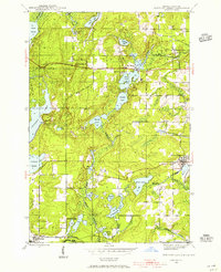
1947 Map of Naults
USGS Topo · Published 1947About this map
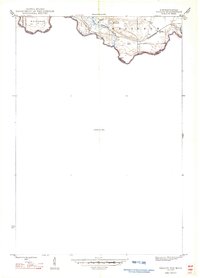
The Brule River forms a jagged natural boundary between Wisconsin and Michigan on this 1947 survey, defining the southern edge of the Mastodon area. This landscape was largely dominated by the timber and transport economy of the mid-20th century, centered on the Chicago and Northwestern railroad line. The settlement of Naults sits along these tracks, serving as a key point of reference in a terrain characterized by wetlands and small waterways like Mud Lake and the W Branch Armstrong Creek. Interestingly, a significant portion of the map is designated as an Unsurveyed Area, reflecting the frontier nature of this northern borderland during the postwar period. Local watercourses such as McGoverns Cr drain this wooded interior, illustrating the topographical isolation of the region at the time of the 1945 mapping.
Find a feature on this map
12 named features on this map. Tap any name to fly to it.
Don’t see what you’re looking for? This feature index may not catch every label — zoom into the map to look around manually.
Map Details
Editions of this 1947 Naults Map
This is the sole edition of this map. No revisions or reprints were ever made.
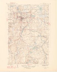
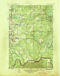
Other maps of this area

1898 · Iron River
USGS Topo · 1:62,500

1899 · Crystal Falls
USGS Topo · 1:62,500
1939 · Long Lake
USGS Topo · 1:48,000

1941 · Florence
USGS Topo · 1:48,000
1944 · Crystal Falls
USGS Topo · 1:24,000
1944 · Gaastra
USGS Topo · 1:24,000
1944 · Fortune Lakes
USGS Topo · 1:24,000
1946 · Crystal Falls
USGS Topo · 1:31,680
1946 · Gaastra
USGS Topo · 1:31,680

1946 · Fortune Lakes
USGS Topo · 1:31,680