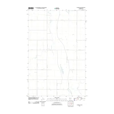
2010 Map of Florian NE
USGS Topo · Published 2010About this map
Tamarac River winds through the northern portion of this Marshall County landscape, while the Middle River crosses the southern reaches, highlighting the drainage patterns characteristic of this part of Minnesota. The map reveals a strictly regulated grid of section lines and gravel roads, including the notable Pembina Trl NW, a name that evokes the historic oxcart trails of the Red River Valley. Much of the terrain is defined by this geometric precision, with routes like County Hwy 39 and 420th St NW serving the surrounding agricultural lands. The lack of concentrated settlement labels suggests a sparsely populated rural district where the economy is tied closely to the land and the waterways that traverse it.
Find a feature on this map
15 named features on this map. Tap any name to fly to it.
Don’t see what you’re looking for? This feature index may not catch every label — zoom into the map to look around manually.
Map Details
Editions of this 2010 Florian NE Map
This is the sole edition of this map. No revisions or reprints were ever made.
Other maps of this area

1919 · Pelan
USGS Topo · 1:62,500

1952 · Thief River Falls
USGS Topo · 1:250,000

1956 · Thief River Falls
USGS Topo · 1:250,000

1956 · Karlstad
USGS Topo · 1:62,500

1956 · Florian
USGS Topo · 1:62,500

1957 · Thief River Falls
USGS Topo · 1:250,000

1957 · Newfolden
USGS Topo · 1:62,500

1957 · Pelan
USGS Topo · 1:62,500

1967 · Thief River Falls
USGS Topo · 1:250,000
1982 · Florian SE
USGS Topo · 1:24,000