
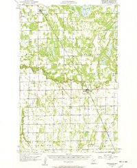
1957 Map of Newfolden
USGS Topo · Published 1958About this map
Newfolden and Strandquist serve as the primary hubs for this agricultural landscape in Marshall County, defined by the winding course of the Middle River and the Minneapolis St Paul and Sault Ste Marie railroad. The 1957 topography reveals a community structured around a network of country churches and rural schools, such as Edgewood Sch and Mamrelund Ch. A high density of local cemeteries, including Oak Grove Cem, Sorenson Cem, and Bethesda Cem, provides essential data points for genealogists tracing family histories in townships like Lincoln and Marsh Grove. The settlement of Ellerth and landmarks like the Town Hall reflect the civic organization of this Red River Valley region during the late 1950s, while the Snake River cuts through the southern reaches near Viking.
Find a feature on this map
30 named features on this map. Tap any name to fly to it.
Don’t see what you’re looking for? This feature index may not catch every label — zoom into the map to look around manually.
Map Details
Editions of this 1957 Newfolden Map
2 editions found
Other maps of this area

1918 · Angus
USGS Topo · 1:62,500

1918 · Viking
USGS Topo · 1:62,500

1918 · Greenbush
USGS Topo · 1:62,500

1918 · Middle River
USGS Topo · 1:62,500

1919 · Pelan
USGS Topo · 1:62,500

1943 · Thief River Falls
USGS Topo · 1:62,500

1952 · Thief River Falls
USGS Topo · 1:250,000

1956 · Thief River Falls
USGS Topo · 1:250,000

1956 · Karlstad
USGS Topo · 1:62,500

1956 · Florian
USGS Topo · 1:62,500