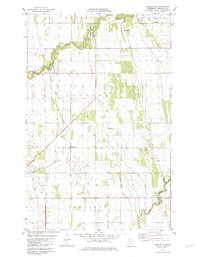
1982 Map of Florian SE
USGS Topo · Published 1982About this map
Old Mill State Park serves as the central landmark for this section of Marshall County, centered on a meandering stretch of the Middle River. The landscape is defined by the transition from the river's wooded banks to the flat agricultural plains of the Red River Valley, divided into the distinct townships of Wright, West Valley, Foldahl, and Comstock. Genealogy researchers will find several localized sites of interest, including the Foldahl Cem in the northeast and Township Cem to the south. The southern edge of the map is marked by the course of the Snake River, while Swift Coulee cuts through the western fields. Scattered across the terrain are several industrial markers, including various Gravel Pits and a solitary Townhall, reflecting the sparse but organized rural development of the early 1980s.
Find a feature on this map
14 named features on this map. Tap any name to fly to it.
Don’t see what you’re looking for? This feature index may not catch every label — zoom into the map to look around manually.
Map Details
Editions of this 1982 Florian SE Map
This is the sole edition of this map. No revisions or reprints were ever made.
Other maps of this area

1918 · Angus
USGS Topo · 1:62,500

1918 · Viking
USGS Topo · 1:62,500

1952 · Thief River Falls
USGS Topo · 1:250,000

1956 · Thief River Falls
USGS Topo · 1:250,000

1956 · Florian
USGS Topo · 1:62,500

1957 · Thief River Falls
USGS Topo · 1:250,000

1957 · Newfolden
USGS Topo · 1:62,500

1959 · Viking
USGS Topo · 1:24,000

1961 · Radium
USGS Topo · 1:24,000
1961 · Roan
USGS Topo · 1:24,000