
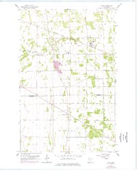
1959 Map of Viking
USGS Topo · Published 1960About this map
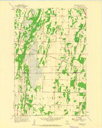
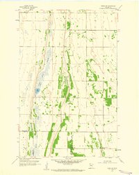
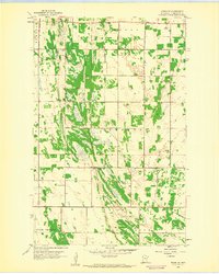
The agrarian landscape of Marshall and Pennington Counties is defined here by the diagonal passage of the Minneapolis St Paul and Sault Ste Marie railroad, which anchors the small village of Viking. This 1959-era topography shows a transition from the organized grid of the Red River Valley to the more varied drainage patterns of the South Branch Snake River. The map reveals the local social geography of the late 1950s, highlighting the Roosevelt Sch and a centrally located Town Hall.
Find a feature on this map
12 named features on this map. Tap any name to fly to it.
Don’t see what you’re looking for? This feature index may not catch every label — zoom into the map to look around manually.
Map Details
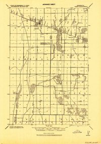
Editions of this 1959 Viking Map
2 editions found
Other maps of this area

1918 · Angus
USGS Topo · 1:62,500
1918 · Viking
USGS Topo · 1:62,500

1952 · Thief River Falls
USGS Topo · 1:250,000

1956 · Thief River Falls
USGS Topo · 1:250,000
1956 · Florian
USGS Topo · 1:62,500

1957 · Thief River Falls
USGS Topo · 1:250,000
1957 · Newfolden
USGS Topo · 1:62,500
1959 · Rosewood
USGS Topo · 1:24,000
1959 · Viking SW
USGS Topo · 1:24,000
1959 · Viking SE
USGS Topo · 1:24,000