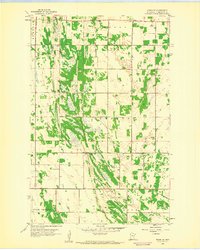
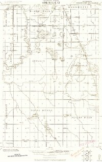
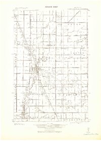
1959 Map of Viking SE
USGS Topo · Published 1960About this map
Norden and Sanders townships define the agrarian landscape of Pennington County in this late 1950s record, where the flat Red River Valley terrain is punctuated by small woodlots and organized drainage. The map reveals a tight-knit rural community structure, anchored by the Norden Ch and two distinct community Town Halls. Local genealogy and land use patterns are well-preserved through markers such as the Lafstad Cem and Rux Cem, which sit alongside evidence of local industry in the form of numerous Gravel Pits. The surveying of Black River and Polk Centre townships further south highlights the systematic expansion of the county's road and section networks. This detailed planetable survey provides an exact layout of the farmsteads and rural infrastructure before modern agricultural consolidation shifted the character of these northwestern Minnesota prairie townships.
Find a feature on this map
12 named features on this map. Tap any name to fly to it.
Don’t see what you’re looking for? This feature index may not catch every label — zoom into the map to look around manually.
Map Details
Editions of this 1959 Viking SE Map
This is the sole edition of this map. No revisions or reprints were ever made.
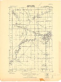
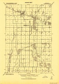
Other maps of this area
1918 · Terrebonne
USGS Topo · 1:62,500
1918 · Red Lake Falls
USGS Topo · 1:62,500
1918 · Viking
USGS Topo · 1:62,500
1943 · Thief River Falls
USGS Topo · 1:62,500
1952 · Red Lake Falls
USGS Topo · 1:62,500

1952 · Grand Forks
USGS Topo · 1:250,000

1952 · Thief River Falls
USGS Topo · 1:250,000

1956 · Thief River Falls
USGS Topo · 1:250,000

1956 · Grand Forks
USGS Topo · 1:250,000

1957 · Thief River Falls
USGS Topo · 1:250,000