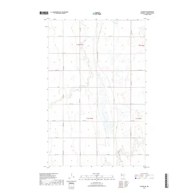
2019 Map of Florian NE
USGS Topo · Published 2019About this map
Tamarac River meanders through the northwest corner of this agricultural landscape in Marshall County, while the Middle River cuts across the southeast. This 2019 survey illustrates the methodical township and range grid system of t158n r46w and its neighbors, where the land is primarily divided by straight-line section roads such as 420th St NW and 250th Ave NW. One notable exception to the modern grid is the Pembina Tr Rd NW, which cuts North-South through the center of the sheet, tracing a path that diverges from the standard section lines and suggests an older historical route through these prairie wetlands. The landscape is dotted with numerous small depressional wetlands, characteristic of the glacial plains in this region of northern Minnesota. Significant county corridors including Co Hwy 6 and Co Hwy 30 provide the primary east-west connectivity for local farmsteads.
Find a feature on this map
20 named features on this map. Tap any name to fly to it.
Don’t see what you’re looking for? This feature index may not catch every label — zoom into the map to look around manually.
Map Details
Editions of this 2019 Florian NE Map
This is the sole edition of this map. No revisions or reprints were ever made.
Other maps of this area

1919 · Pelan
USGS Topo · 1:62,500

1952 · Thief River Falls
USGS Topo · 1:250,000

1956 · Thief River Falls
USGS Topo · 1:250,000

1956 · Karlstad
USGS Topo · 1:62,500

1956 · Florian
USGS Topo · 1:62,500

1957 · Thief River Falls
USGS Topo · 1:250,000

1957 · Newfolden
USGS Topo · 1:62,500

1957 · Pelan
USGS Topo · 1:62,500

1967 · Thief River Falls
USGS Topo · 1:250,000
1982 · Florian SE
USGS Topo · 1:24,000