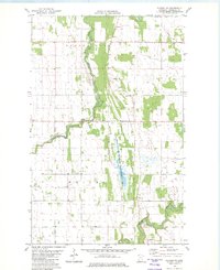
1982 Map of Florian NE
USGS Topo · Published 1982About this map
The Tamarac River meanders through the northwest corner of Marshall County, defining a landscape shaped by early drainage efforts and a mosaic of public and private lands. This early 1980s survey captures the region as the Florian State Wildlife Management Area preserved a significant wetland corridor, contrasting with the structured agricultural sections in Nelson Park and Wright townships. The map is a valuable resource for local history, showing the Assumption Cem and a centrally located Townhall that anchor the rural community.
Find a feature on this map
13 named features on this map. Tap any name to fly to it.
Don’t see what you’re looking for? This feature index may not catch every label — zoom into the map to look around manually.
Map Details
Editions of this 1982 Florian NE Map
This is the sole edition of this map. No revisions or reprints were ever made.
Other maps of this area

1919 · Pelan
USGS Topo · 1:62,500

1952 · Thief River Falls
USGS Topo · 1:250,000

1956 · Thief River Falls
USGS Topo · 1:250,000

1956 · Karlstad
USGS Topo · 1:62,500

1956 · Florian
USGS Topo · 1:62,500

1957 · Thief River Falls
USGS Topo · 1:250,000

1957 · Newfolden
USGS Topo · 1:62,500

1957 · Pelan
USGS Topo · 1:62,500

1967 · Thief River Falls
USGS Topo · 1:250,000
1982 · Florian SE
USGS Topo · 1:24,000