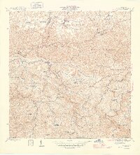
1946 Map of Florida
USGS Topo · Published 1946About this map
The town of Florida sits within a landscape defined by an extensive network of haciendas and agricultural estates during the mid-1940s. These landed properties, including Hacienda San José, Hacienda Las Abras, and Hacienda Peñonales, were central to the rural economy and social structure of the interior. The map illustrates the transition from the coastal plains into the complex drainage systems of the Río Limón and Río Toro Negro, where numerous quebradas like Quebrada Yunes carve through the terrain. Educational centers such as the Escuela Segunda Unidad de Mameyes and Escuela Segunda Unidad de Frontón point to the organized community hubs established amid the dispersed settlements of Mameyes Arriba and Florida Adentro. Local movement relied on a mix of paths including La Venta and several established trails marked as Vereda.
Find a feature on this map
66 named features on this map. Tap any name to fly to it.
Don’t see what you’re looking for? This feature index may not catch every label — zoom into the map to look around manually.
Map Details
Editions of this 1946 Florida Map
3 editions found
Other maps of this area

1942 · Manati
USGS Topo · 1:30,000

1942 · Arecibo
USGS Topo · 1:30,000

1942 · Barceloneta
USGS Topo · 1:30,000

1943 · Utuado NE
USGS Topo · 1:10,000

1946 · Barceloneta
USGS Topo · 1:30,000

1946 · Utuado
USGS Topo · 1:30,000

1946 · Ciales
USGS Topo · 1:30,000

1946 · Jayuya
USGS Topo · 1:30,000

1946 · Arecibo
USGS Topo · 1:30,000

1946 · Florida
USGS Topo · 1:30,000