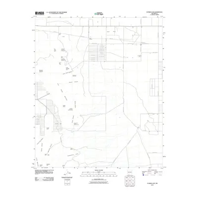
2010 Map of Florida Gap
USGS Topo · Published 2010About this map
Lewis Flats and the nearby Lewis Cemetery anchor the northern landscape of this Luna County region, where the desert flats meet the rising slopes of the Little Florida Mountains. The area is defined by a deep history of mineral extraction, with numerous sites such as the Florida Mine, American Number Twenty Nine, and the Manganese Valley Mine clustered around the peaks and canyons. This industrial footprint is woven into a terrain marked by distinctive landmarks like Indian Post Office and the prominent Florida Peak. Ranching interests are represented by the Nunn Ranch and Kil Ranch, positioned near drainages like Headquarters Draw. The map reveals a transition from the structured grid of rural roads, including Saguaro Rd and Joshua Rd, to the winding topographic features of Black Rock Canyon and Florida Gap, reflecting the shift from settlement to the high desert wilderness.
Find a feature on this map
72 named features on this map. Tap any name to fly to it.
Don’t see what you’re looking for? This feature index may not catch every label — zoom into the map to look around manually.
Map Details
Editions of this 2010 Florida Gap Map
This is the sole edition of this map. No revisions or reprints were ever made.
Other maps of this area

1899 · Deming
USGS Topo · 1:125,000

1915 · Deming
USGS Topo · 1:125,000

1955 · Las Cruces
USGS Topo · 1:250,000

1958 · Las Cruces
USGS Topo · 1:250,000

1964 · Gym Peak
USGS Topo · 1:24,000

1964 · Florida Gap
USGS Topo · 1:24,000

1965 · South Peak
USGS Topo · 1:24,000

1965 · Deming East
USGS Topo · 1:24,000

1965 · Carne
USGS Topo · 1:24,000
1965 · Capitol Dome
USGS Topo · 1:24,000