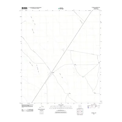
2010 Map of Florida
USGS Topo · Published 2010About this map
Florida and the nearby Nunn Ranch anchor this high-desert landscape in Luna County, where water management is the defining feature of human settlement. The territory is crisscrossed by a network of drainage ways, including the evocative Finger Ring Draw, Chandler Draw, and the prominent Hadley Draw. These seasonal watercourses dictate the layout of local infrastructure, such as County Rd-A019 and County Rd-A021, which navigate the arid terrain. The map reveals the critical importance of groundwater for ranching operations, evidenced by several named water points such as Dobies Windmill, Miller Windmill, and Britan Windmill. Historical pathways are further suggested by the naming of Cookes Canyon and Fort Cummings Draw, pointing to the region’s strategic role in westward transit. This documentation reflects a modern era of land use where large-scale ranching and desert drainage systems continue to shape the rural character of the New Mexico landscape.
Find a feature on this map
15 named features on this map. Tap any name to fly to it.
Don’t see what you’re looking for? This feature index may not catch every label — zoom into the map to look around manually.
Map Details
Editions of this 2010 Florida Map
This is the sole edition of this map. No revisions or reprints were ever made.
Other maps of this area

1899 · Deming
USGS Topo · 1:125,000

1915 · Deming
USGS Topo · 1:125,000

1955 · Las Cruces
USGS Topo · 1:250,000

1958 · Las Cruces
USGS Topo · 1:250,000

1961 · Nutt
USGS Topo · 1:62,500

1962 · Lake Valley
USGS Topo · 1:62,500

1964 · Florida
USGS Topo · 1:24,000

1964 · Massacre Peak
USGS Topo · 1:24,000

1965 · Deming East
USGS Topo · 1:24,000

1965 · Carne
USGS Topo · 1:24,000