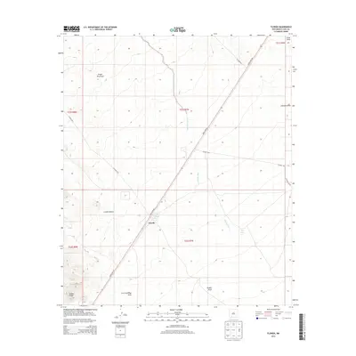
2013 Map of Florida
USGS Topo · Published 2013About this map
Cooks Spring Historic Site serves as a focal point for this high-desert landscape in Luna County, marking a critical water source and transit point in the arid terrain. The settlement of Florida is positioned near the intersection of the modern Hatch Hwy NE and several county roads, illustrating how historical movement patterns evolved into contemporary infrastructure. The southwest corner of the map is dominated by the elevations of the Cookes Range and the winding path of Cookes Canyon, a corridor of deep historical significance for travelers in the Southwest. The landscape is defined by an intricate network of drainage features, including Fort Cummings Draw, Hadley Draw, and the seasonal waters of Mule Springs Creek. These geographic markers provide essential context for understanding the early settlement and ranching history of the region.
Find a feature on this map
22 named features on this map. Tap any name to fly to it.
Don’t see what you’re looking for? This feature index may not catch every label — zoom into the map to look around manually.
Map Details
Editions of this 2013 Florida Map
This is the sole edition of this map. No revisions or reprints were ever made.
Other maps of this area

1899 · Deming
USGS Topo · 1:125,000

1915 · Deming
USGS Topo · 1:125,000

1955 · Las Cruces
USGS Topo · 1:250,000

1958 · Las Cruces
USGS Topo · 1:250,000

1961 · Nutt
USGS Topo · 1:62,500

1962 · Lake Valley
USGS Topo · 1:62,500

1964 · Florida
USGS Topo · 1:24,000

1964 · Massacre Peak
USGS Topo · 1:24,000

1965 · Deming East
USGS Topo · 1:24,000

1965 · Carne
USGS Topo · 1:24,000