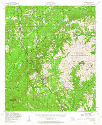
1954 Map of Florien
USGS Topo · Published 1963About this map
The Kansas City Southern railroad serves as the industrial spine for this mid-century survey of western Louisiana, connecting the timber-associated settlements of Fisher, Florien, and Hornbeck. While the rail corridor anchors the western half of the landscape, the east is dominated by the Fort Polk Military Reservation, featuring the Peason Ridge Artillery Range. This military expansion pushed up against established rural life, as seen in the numerous community landmarks like the Plainview School and Liberty Chapel. For genealogists, the map is remarkably dense with family-linked sites, including the Beckham Cem, Sibley Cem, and the Prewitts Chapel Cem. Terrain varies from the high vantage of Eagle Hill and the Peason Fire Tower to the complex wetlands of La Nana Grant and the Monks Hammock, illustrating a landscape in transition between traditional agriculture and modern federal use.
Find a feature on this map
74 named features on this map. Tap any name to fly to it.
Don’t see what you’re looking for? This feature index may not catch every label — zoom into the map to look around manually.
Map Details
Editions of this 1954 Florien Map
3 editions found

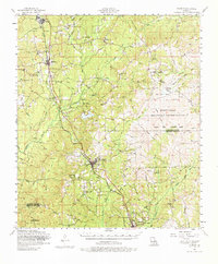
Other maps of this area

1937 · Bellwood
USGS Topo · 1:31,680

1941 · Leesville
USGS Topo · 1:62,500

1941 · Zwolle
USGS Topo · 1:62,500

1941 · Slagle
USGS Topo · 1:62,500

1942 · Many
USGS Topo · 1:62,500

1942 · Florien
USGS Topo · 1:62,500

1942 · Kisatchie
USGS Topo · 1:62,500

1943 · Leesville
USGS Topo · 1:62,500

1943 · Many
USGS Topo · 1:62,500

1943 · Kisatchie
USGS Topo · 1:62,500