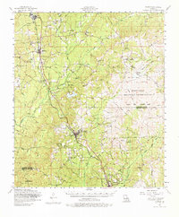
1954 Map of Florien
USGS Topo · Published 1976About this map
Hornbeck and Florien serve as the primary rail-connected hubs along this 1954 survey of the Sabine and Vernon Parish border. The Kansas City Southern railroad dictates the local geography, passing through Fisher, Sandel, and Gandy as it navigates the watershed between Toro Bayou and Anacoco Creek. This era reveals a landscape shaped by military expansion and timber, characterized by the expansive Fort Polk Military Reservation and its Peason Ridge Artillery Range dominating the eastern half of the map.
Find a feature on this map
79 named features on this map. Tap any name to fly to it.
Don’t see what you’re looking for? This feature index may not catch every label — zoom into the map to look around manually.
Map Details
Editions of this 1954 Florien Map
3 editions found

Other maps of this area

1937 · Bellwood
USGS Topo · 1:31,680

1941 · Leesville
USGS Topo · 1:62,500

1941 · Zwolle
USGS Topo · 1:62,500

1941 · Slagle
USGS Topo · 1:62,500

1942 · Many
USGS Topo · 1:62,500

1942 · Florien
USGS Topo · 1:62,500

1942 · Kisatchie
USGS Topo · 1:62,500

1943 · Leesville
USGS Topo · 1:62,500

1943 · Many
USGS Topo · 1:62,500

1943 · Kisatchie
USGS Topo · 1:62,500