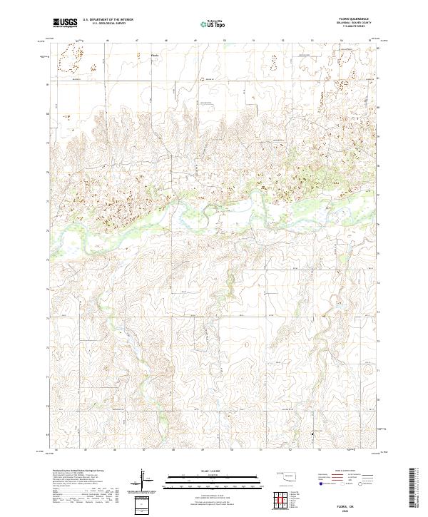
2022 Map of Floris
USGS Topo · Published 2022About this map
Floris stands at the northern edge of this panhandle landscape, situated within a grid of section lines that define the agricultural character of Beaver County. The terrain is marked by the wide course of the Beaver River, which winds across the central portion of the quadrangle. Several drainage systems, including Elm Cr and Willow Cr, flow toward the main river channel, creating a complex series of draws and breaks in the High Plains surface. To the south, Dugout Cr cuts through the township boundaries, illustrating the natural erosion patterns typical of the region's semi-arid environment.
Find a feature on this map
29 named features on this map. Tap any name to fly to it.
Don’t see what you’re looking for? This feature index may not catch every label — zoom into the map to look around manually.
Map Details
Editions of this 2022 Floris Map
This is the sole edition of this map. No revisions or reprints were ever made.
Other maps of this area

1954 · Perryton
USGS Topo · 1:250,000

1958 · Perryton
USGS Topo · 1:250,000

1973 · Balko
USGS Topo · 1:24,000

1973 · Boyd
USGS Topo · 1:24,000

1973 · Balko NE
USGS Topo · 1:24,000

1973 · Floris
USGS Topo · 1:24,000
1973 · Forgan
USGS Topo · 1:24,000

1973 · Turpin East
USGS Topo · 1:24,000

1973 · Beaver
USGS Topo · 1:24,000
1973 · Beaver NW
USGS Topo · 1:24,000