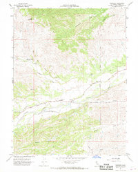
1967 Map of Flournoy
USGS Topo · Published 1968About this map
Flournoy sits at the intersection of early settlement history and the complex geography of Northern California's interior. This survey documents a landscape defined by the drainage of Thomes Creek and its many tributaries, including McCarty Creek and McClure Creek. Of significant historical interest is the presence of the Name Lackee Indian Reservation Monument, marking the site of one of the state's earliest federal reservations. The map clearly delineates legal and historical thresholds such as the Indian Treaty Boundary and the Paskenta Treaty Boundary, reflecting the 19th-century land divisions of Tehama County.
Find a feature on this map
25 named features on this map. Tap any name to fly to it.
Don’t see what you’re looking for? This feature index may not catch every label — zoom into the map to look around manually.
Map Details
Editions of this 1967 Flournoy Map
2 editions found
Other maps of this area

1890 · Red Bluff
USGS Topo · 1:250,000

1894 · Red Bluff
USGS Topo · 1:250,000

1944 · Flournoy
USGS Topo · 1:62,500

1949 · Colyear Springs
USGS Topo · 1:62,500

1951 · West of Gerber
USGS Topo · 1:24,000

1952 · Red Bank
USGS Topo · 1:24,000

1952 · Paskenta
USGS Topo · 1:62,500

1952 · Red Bank
USGS Topo · 1:62,500

1957 · Colyear Springs
USGS Topo · 1:62,500

1957 · Ukiah
USGS Topo · 1:250,000