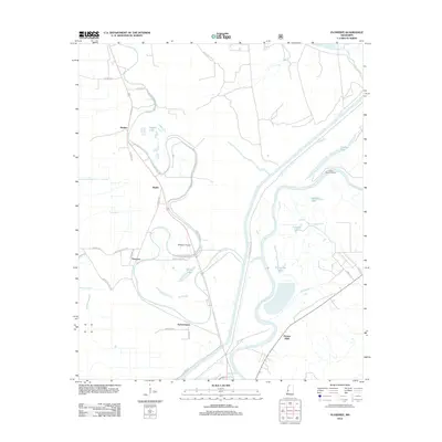
2012 Map of Floweree
USGS Topo · Published 2012About this map
Yazoo River backwaters and the fertile bottomlands of the Mississippi Delta define this landscape north of Vicksburg. Small rural communities like Floweree and Hardee dot the western reaches, connected by a network of local roads including Reischer Rd and Floweree Rd. The hydrology of the region is prominently mapped, showing the complex interaction between Deer Cr and numerous oxbow features such as Hardee Lake and Horseshoe Lake. East of the river, the terrain rises toward Haynes Bluff, a significant topographical transition that overlooks the alluvial plain. Aviation interests are represented by Whitaker Airport, while industrial and agricultural infrastructure is evident in the presence of the Levee Maintenance Rd and various canal systems like Canal Rd designed to manage the delta's abundant water.
Find a feature on this map
34 named features on this map. Tap any name to fly to it.
Don’t see what you’re looking for? This feature index may not catch every label — zoom into the map to look around manually.
Map Details
Editions of this 2012 Floweree Map
This is the sole edition of this map. No revisions or reprints were ever made.
Other maps of this area

1918 · Vicksburg
USGS Topo · 1:62,500

1938 · Edwards
USGS Topo · 1:62,500

1939 · Onward
USGS Topo · 1:62,500

1940 · Mechanicsburg
USGS Topo · 1:62,500

1941 · Vicksburg
USGS Topo · 1:62,500

1955 · Jackson
USGS Topo · 1:250,000

1961 · Jackson
USGS Topo · 1:250,000

1962 · Jackson
USGS Topo · 1:250,000

1962 · Redwood
USGS Topo · 1:24,000
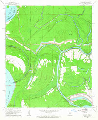
1962 · Long Lake
USGS Topo · 1:24,000