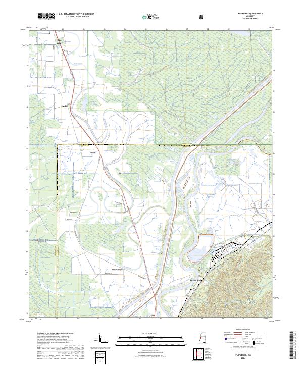
2024 Map of Floweree
USGS Topo · Published 2024About this map
The Yazoo River defines the landscape of this delta region, winding through a complex network of wetlands and historic drainage patterns north of the Vicksburg area. This survey documents the intersection of agricultural holdings and the preserved woodlands of the Delta National Forest, where old settlements like Floweree and Walsh are situated along the banks of Deer Creek. The presence of Whitaker Airport and several named roads such as Whitaker Rd and Floweree Rd trace the evolution of local transport beyond the original river-dependent economy.
Find a feature on this map
41 named features on this map. Tap any name to fly to it.
Don’t see what you’re looking for? This feature index may not catch every label — zoom into the map to look around manually.
Map Details
Editions of this 2024 Floweree Map
This is the sole edition of this map. No revisions or reprints were ever made.
Other maps of this area

1918 · Vicksburg
USGS Topo · 1:62,500

1938 · Edwards
USGS Topo · 1:62,500

1939 · Onward
USGS Topo · 1:62,500

1940 · Mechanicsburg
USGS Topo · 1:62,500

1941 · Vicksburg
USGS Topo · 1:62,500

1955 · Jackson
USGS Topo · 1:250,000

1961 · Jackson
USGS Topo · 1:250,000

1962 · Jackson
USGS Topo · 1:250,000

1962 · Redwood
USGS Topo · 1:24,000
1962 · Long Lake
USGS Topo · 1:24,000