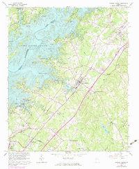
1964 Map of Flowery Branch
USGS Topo · Published 1974About this map
The sprawling waters of Lake Sidney Lanier dominate the western landscape of this mid-1960s survey, illustrating the significant environmental transformation of the Chattahoochee River valley. Several access points such as Vanns Tavern and Williams Ferry preserve the names of older river crossings that were superseded by the reservoir. Inland, the Southern railroad corridor anchors the communities of Flowery Branch and Oakwood, serving as a primary transportation artery through Hall County.
Find a feature on this map
58 named features on this map. Tap any name to fly to it.
Don’t see what you’re looking for? This feature index may not catch every label — zoom into the map to look around manually.
Map Details
Editions of this 1964 Flowery Branch Map
4 editions found
Other maps of this area

1890 · Suwanee
USGS Topo · 1:125,000

1891 · Gainesville
USGS Topo · 1:125,000

1894 · Suwanee
USGS Topo · 1:125,000

1954 · Greenville
USGS Topo · 1:250,000

1955 · Rome
USGS Topo · 1:250,000

1958 · Greenville
USGS Topo · 1:250,000

1958 · Rome
USGS Topo · 1:250,000

1961 · Rome
USGS Topo · 1:250,000

1963 · Rome
USGS Topo · 1:250,000

1964 · Hog Mountain
USGS Topo · 1:24,000