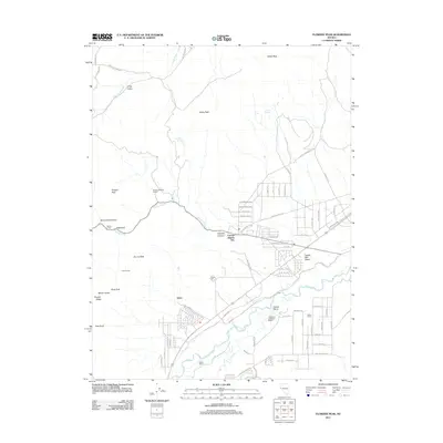
2011 Map of Flowery Peak
USGS Topo · Published 2011About this map
The Flowery Mining District dominates the high ground of the Virginia Range, where peaks like Flowery Peak, Mount Grosh, and Emma Peak stand as sentinels over a landscape defined by historic silver and gold extraction. In the lowlands, the settlement of Sutro sits near the namesake Sutro Tunnel, a massive 19th-century engineering feat designed to drain the Comstock Lode mines. The terrain transitions from the high ridges of Flowery Ridge down to the Carson Plains and the Twelve Mile Desert, where the Carson River carves a path through the arid valley. Rural life is evidenced by family-named holdings such as Quilici Ranch and Heidenreich and Miner Ranch, while roads like Roughing It Rd and Sam Clemens Ave pay homage to the region's literary and mining history near Carson Rapids City.
Find a feature on this map
74 named features on this map. Tap any name to fly to it.
Don’t see what you’re looking for? This feature index may not catch every label — zoom into the map to look around manually.
Map Details
Editions of this 2011 Flowery Peak Map
This is the sole edition of this map. No revisions or reprints were ever made.
Other maps of this area

1891 · Carson
USGS Topo · 1:125,000

1891 · Wabuska
USGS Topo · 1:125,000

1893 · Carson
USGS Topo · 1:125,000

1894 · Wabuska
USGS Topo · 1:125,000

1950 · Virginia City
USGS Topo · 1:62,500

1952 · Virginia City
USGS Topo · 1:62,500

1956 · Dayton
USGS Topo · 1:62,500

1957 · Como
USGS Topo · 1:62,500

1957 · Churchill Butte
USGS Topo · 1:62,500

1957 · Reno
USGS Topo · 1:250,000