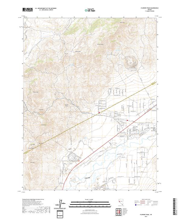
2021 Map of Flowery Peak
USGS Topo · Published 2021About this map
Sutro and the northern outskirts of Dayton represent the primary points of human settlement in this high-desert landscape of the Virginia Range. The presence of Sutro Tunnel Rd points to the area's deep mining heritage, marking the legacy of the engineering feat designed to drain the Comstock Lode. To the north, the Flowery Range rises with peaks like Flowery Peak and Tibbie Peak, while the southeastern corner transitions into the Twelve Mile Desert and the broad Carson Plains. Transport through this arid terrain follows the deep cut of Sixmile Canyon and the historic path of Gold Canyon. Modern residential development is visible in the network of streets north of the Dayton town center, including Wagon Wheel Way and Roughing It Rd, which contrast with the isolated locations of Sutro Springs and Tocchino Springs.
Find a feature on this map
97 named features on this map. Tap any name to fly to it.
Don’t see what you’re looking for? This feature index may not catch every label — zoom into the map to look around manually.
Map Details
Editions of this 2021 Flowery Peak Map
This is the sole edition of this map. No revisions or reprints were ever made.
Other maps of this area

1891 · Carson
USGS Topo · 1:125,000

1891 · Wabuska
USGS Topo · 1:125,000

1893 · Carson
USGS Topo · 1:125,000

1894 · Wabuska
USGS Topo · 1:125,000

1950 · Virginia City
USGS Topo · 1:62,500

1952 · Virginia City
USGS Topo · 1:62,500

1956 · Dayton
USGS Topo · 1:62,500

1957 · Como
USGS Topo · 1:62,500

1957 · Churchill Butte
USGS Topo · 1:62,500

1957 · Reno
USGS Topo · 1:250,000