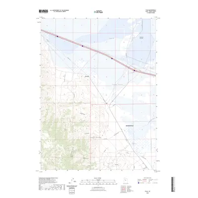
2023 Map of Flux
USGS Topo · Published 2023About this map
The Stansbury Mountains define the southwestern landscape of this Tooele County region, giving way to the broad expanse of Tooele Valley and the northern alkaline flats near Stansbury Bay. The settlement of Grantsville serves as the primary hub, situated near the marshy reaches of Warm Springs Slough. This modern survey illustrates the persistent importance of transportation corridors in the Great Basin, tracing the path of the Old Lincoln Hwy and the industrial footprints at Flux and Dolomite. The topography transitions sharply from the high peaks of Little Mtn and the depths of Kimball Canyon to the level plains of the Stansbury Island Bar, highlighting the geological variety between the mountain range and the Great Salt Lake shoreline.
Find a feature on this map
19 named features on this map. Tap any name to fly to it.
Don’t see what you’re looking for? This feature index may not catch every label — zoom into the map to look around manually.
Map Details
Editions of this 2023 Flux Map
This is the sole edition of this map. No revisions or reprints were ever made.
Other maps of this area

1885 · Tooele Valley
USGS Topo · 1:250,000

1953 · Tooele
USGS Topo · 1:250,000

1955 · Timpie
USGS Topo · 1:62,500

1955 · Burmester
USGS Topo · 1:24,000

1955 · Grantsville
USGS Topo · 1:24,000

1955 · Tooele
USGS Topo · 1:250,000

1968 · Poverty Point
USGS Topo · 1:24,000

1968 · Corral Canyon
USGS Topo · 1:24,000
1968 · Plug Peak
USGS Topo · 1:24,000
1972 · Burmester
USGS Topo · 1:24,000