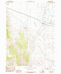
1985 Map of Flux
USGS Topo · Published 1985About this map
Industrial extraction and conservation coexist in this mid-1980s look at the eastern edge of the Stansbury Mountains. The landscape is defined by the sharp transition from high canyon terrain into the Tooele Valley, where specialized infrastructure like Salt Evaporators and an extensive Pipeline reflect the region's mineral economy. Small industrial hubs at Flux and Dolomite sit along the base of the mountains, while the northern reaches are dominated by the Timpie Springs Waterfowl Mgmt Area and Mud Flat expanses.
Find a feature on this map
22 named features on this map. Tap any name to fly to it.
Don’t see what you’re looking for? This feature index may not catch every label — zoom into the map to look around manually.
Map Details
Editions of this 1985 Flux Map
This is the sole edition of this map. No revisions or reprints were ever made.
Other maps of this area

1885 · Tooele Valley
USGS Topo · 1:250,000

1953 · Tooele
USGS Topo · 1:250,000

1955 · Timpie
USGS Topo · 1:62,500

1955 · Burmester
USGS Topo · 1:24,000

1955 · Grantsville
USGS Topo · 1:24,000

1955 · Tooele
USGS Topo · 1:250,000

1968 · Poverty Point
USGS Topo · 1:24,000

1968 · Corral Canyon
USGS Topo · 1:24,000
1968 · Plug Peak
USGS Topo · 1:24,000
1972 · Burmester
USGS Topo · 1:24,000