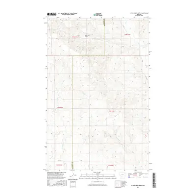
2017 Map of Flynn Creek North
USGS Topo · Published 2017About this map
Badger Hole Coulee and a network of seasonal watercourses define this portion of the Montana plains, situated along the border of Valley and Roosevelt counties. The drainage patterns of Wolf Cr in the northeast and Flynn Cr in the southwest illustrate the subtle but complex topography of the Missouri River watershed. The land is organized by the Public Land Survey System, with the map covering portions of several townships including t29n r45e and t28n r46e. Local transport is facilitated by a grid of rural roads, including Nygaard Rd and Wolf Creek Rd, which follow the section lines and natural contours of the drainages. While no major towns appear, the distribution of these routes and the naming of features like E Fork Flynn Cr and Littleman Cr suggest a landscape shaped by ranching and traditional land use in the Wolf Point District.
Find a feature on this map
18 named features on this map. Tap any name to fly to it.
Don’t see what you’re looking for? This feature index may not catch every label — zoom into the map to look around manually.
Map Details
Editions of this 2017 Flynn Creek North Map
This is the sole edition of this map. No revisions or reprints were ever made.
Other maps of this area

1910 · Todd Lakes
USGS Topo · 1:62,500

1915 · Tule Valley
USGS Topo · 1:62,500

1915 · Oswego
USGS Topo · 1:62,500

1915 · Todd Lakes
USGS Topo · 1:62,500

1916 · Wolf Point
USGS Topo · 1:62,500

1954 · Wolf Point
USGS Topo · 1:250,000

1958 · Wolf Point
USGS Topo · 1:250,000

1972 · Flynn Creek North
USGS Topo · 1:24,000

1972 · Wolf Point
USGS Topo · 1:24,000
1972 · Flynn Creek South
USGS Topo · 1:24,000