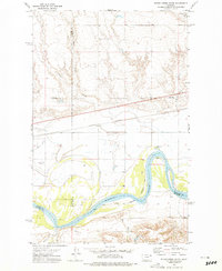
1972 Map of Flynn Creek South
USGS Topo · Published 1975About this map
Fort Peck Indian Reservation lands dominate this northern Montana landscape, where the wide meanders of the Missouri River define the southern reaches of the map. In the early 1970s, the region's infrastructure was shaped by the Burlington Northern railroad and a significant Pipeline corridor, both running parallel to the river valley. The small community hub around Oswego Ch and its nearby Cem stands as a focal point for local history and genealogy, situated near the mouth of Oswego Creek. The terrain is characterized by intricate drainage systems including Flynn Creek and Littleman Creek, while the presence of the Main Canal indicates the vital role of irrigation and water management in this prairie environment. The map also captures the precise meeting of several county lines, including the borders of Valley, McCone, and Roosevelt counties.
Find a feature on this map
18 named features on this map. Tap any name to fly to it.
Don’t see what you’re looking for? This feature index may not catch every label — zoom into the map to look around manually.
Map Details
Editions of this 1972 Flynn Creek South Map
2 editions found

Other maps of this area

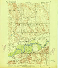
1915 · Oswego
USGS Topo · 1:62,500
1916 · Wolf Point
USGS Topo · 1:62,500

1954 · Glendive
USGS Topo · 1:250,000

1954 · Wolf Point
USGS Topo · 1:250,000

1957 · Glendive
USGS Topo · 1:250,000

1958 · Wolf Point
USGS Topo · 1:250,000

1958 · Glendive
USGS Topo · 1:250,000

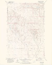
1972 · Flynn Creek North
USGS Topo · 1:24,000
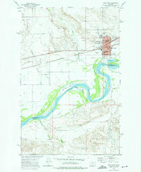
1972 · Wolf Point
USGS Topo · 1:24,000
1972 · Oswego NW
USGS Topo · 1:24,000
Featured Places
- Wolf Point District, MT
- Prairie Elk Hutterite Colony, MT
- Oswego District, MT
- Roosevelt County, MT
- McCone County, MT