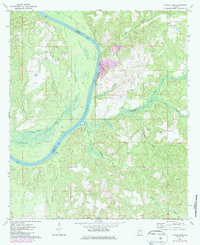
1972 Map of Flynns Lake
USGS Topo · Published 1986About this map
The Alabama River winds through the heart of the Monroe and Clarke county line, defining a landscape of active landings and riverfront commerce as it appeared in the early 1970s. This stretch of the river is marked by historic access points including Dale Ferry Landing, Howard Landing, and Baileys Landing, suggesting a long history of water-based transport before modern infrastructure took hold. High ground at Marshalls Bluff overlooks the meandering channel and the wetlands surrounding Flynns Lake. Local community life is anchored by numerous country churches, such as Mt Gilead Ch, Jamestown Ch, and Sunflower Ch, which dot the rural road network. An industrial presence is noted by a Quarry situated near Hollinger Creek, while the interior is drained by a system of named waterways including Marshalls Creek and Randons Creek.
Find a feature on this map
24 named features on this map. Tap any name to fly to it.
Don’t see what you’re looking for? This feature index may not catch every label — zoom into the map to look around manually.
Map Details
Editions of this 1972 Flynns Lake Map
2 editions found
Other maps of this area

1953 · Andalusia
USGS Topo · 1:250,000

1957 · Andalusia
USGS Topo · 1:250,000

1972 · Frisco City
USGS Topo · 1:24,000

1972 · Uriah East
USGS Topo · 1:24,000

1972 · Mexia
USGS Topo · 1:24,000

1972 · Chrysler
USGS Topo · 1:24,000

1972 · Uriah West
USGS Topo · 1:24,000

1972 · Flynns Lake
USGS Topo · 1:24,000

1972 · Gainestown
USGS Topo · 1:24,000

1972 · Claiborne
USGS Topo · 1:24,000