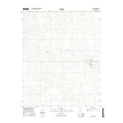
2016 Map of Follett
USGS Topo · Published 2016About this map
Follett serves as the primary center of activity on this high-plains landscape, situated at the intersection of several key regional routes. The town’s grid is clearly defined by residential streets such as N Main St, E Ivanhoe Ave, and Pryor Ave, reflecting a typical 20th-century Panhandle settlement pattern. To the west, the smaller locality of Sherlock sits near the drainage of Indian Cr, one of several seasonal waterways like Ivanhoe Cr and Mammoth Cr that carve subtle relief into the flat terrain. For those researching local family history, the Fairview Cem is a significant landmark located in the southwestern portion of the map. The layout of the county road system, including FM 2741 and Co RD 20, illustrates the expansive agricultural grid that defines this portion of Lipscomb County along the Texas-Oklahoma border.
Find a feature on this map
33 named features on this map. Tap any name to fly to it.
Don’t see what you’re looking for? This feature index may not catch every label — zoom into the map to look around manually.
Map Details
Editions of this 2016 Follett Map
This is the sole edition of this map. No revisions or reprints were ever made.
Other maps of this area

1954 · Perryton
USGS Topo · 1:250,000

1958 · Perryton
USGS Topo · 1:250,000

1971 · Clear Lake SE
USGS Topo · 1:24,000

1971 · Logan
USGS Topo · 1:24,000

1971 · Slapout
USGS Topo · 1:24,000

1972 · Follett SE
USGS Topo · 1:24,000

1972 · Dugout Creek
USGS Topo · 1:24,000

1972 · Skunk Creek
USGS Topo · 1:24,000
1972 · Magoun
USGS Topo · 1:24,000

1972 · Follett
USGS Topo · 1:24,000