
1972 Map of Follett SE
USGS Topo · Published 1974About this map
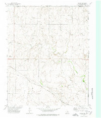
Wolf Creek and Mammoth Creek meander across this section of the Texas Panhandle, carving distinct drainage patterns into the high plains landscape of the early 1970s. The map illustrates a region defined by its energy infrastructure and agricultural boundaries, with numerous Gas Wells and Oil Wells peppered throughout the territory. Along the northern edge, the Atchison Topeka and Santa Fe railroad line cuts across the terrain, serving as a primary transportation artery for the region. The boundary between Texas and Oklahoma is clearly marked on the eastern side, alongside the county line dividing Lipscomb County and Ellis County. This survey provides a precise record of the industrial footprint on the land, from a scattered Gravel Pit to various Drill Holes, reflecting the extraction-based economy that shaped this corner of the state during the era.
Find a feature on this map
13 named features on this map. Tap any name to fly to it.
Don’t see what you’re looking for? This feature index may not catch every label — zoom into the map to look around manually.
Map Details
Editions of this 1972 Follett SE Map
This is the sole edition of this map. No revisions or reprints were ever made.
Other maps of this area

1954 · Perryton
USGS Topo · 1:250,000

1955 · Woodward
USGS Topo · 1:250,000

1958 · Perryton
USGS Topo · 1:250,000

1958 · Woodward
USGS Topo · 1:250,000

1969 · Shattuck
USGS Topo · 1:24,000

1969 · Shattuck NW
USGS Topo · 1:24,000

1970 · Goodwin
USGS Topo · 1:24,000

1972 · Skunk Creek
USGS Topo · 1:24,000
1972 · Magoun
USGS Topo · 1:24,000

1972 · Follett
USGS Topo · 1:24,000