
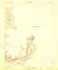
1914 Map of Folsom
USGS Topo · Published 1914About this map
The American River carves through this early twentieth-century landscape, anchoring an area defined by industrial power and gold-recovery operations. At the river's bend, the Power House stands near Folsom, marking a period when hydraulic engineering began to reshape the region's economy. Further downstream, a large Dredge indicates the scale of resource extraction occurring along the banks of the Rio De Los Americanos.
Find a feature on this map
11 named features on this map. Tap any name to fly to it.
Don’t see what you’re looking for? This feature index may not catch every label — zoom into the map to look around manually.
Map Details
Editions of this 1914 Folsom Map
2 editions found
Other maps of this area

1891 · Sacramento
USGS Topo · 1:125,000

1892 · Sacramento
USGS Topo · 1:125,000

1893 · Sacramento
USGS Topo · 1:125,000

1902 · Fairoaks
USGS Topo · 1:62,500

1908 · Buffalo Creek
USGS Topo · 1:31,680

1910 · Roseville
USGS Topo · 1:31,680

1911 · Mills
USGS Topo · 1:31,680

1911 · Antelope
USGS Topo · 1:31,680
1916 · Buffalo Creek
USGS Topo · 1:31,680

1941 · Folsom
USGS Topo · 1:62,500