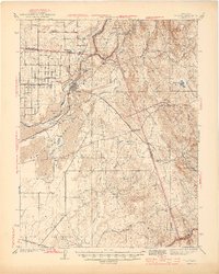
1944 Map of Folsom
USGS Topo · Published 1944About this map
Folsom and its industrial surroundings appear here in the early 1940s, centered on the confluence of the American River forks and the sprawling State Prison Represa. The landscape is defined by the river’s legacy, shown through extensive gravel bars such as Mississippi Bar, Sailor Bar, and Nigger Bar, which reveal the area's history of hydraulic mining and dredging. The Southern Pacific railroad connects these riparian hubs to the burgeoning citrus groves of Orangevale and the smaller railway stops at Natoma and Nimbus.
Find a feature on this map
48 named features on this map. Tap any name to fly to it.
Don’t see what you’re looking for? This feature index may not catch every label — zoom into the map to look around manually.
Map Details
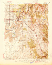
Editions of this 1944 Folsom Map
2 editions found
Other maps of this area

1889 · Jackson
USGS Topo · 1:125,000

1891 · Sacramento
USGS Topo · 1:125,000

1891 · Placerville
USGS Topo · 1:125,000

1892 · Jackson
USGS Topo · 1:125,000

1892 · Sacramento
USGS Topo · 1:125,000

1892 · Placerville
USGS Topo · 1:125,000

1893 · Placerville
USGS Topo · 1:125,000

1893 · Sacramento
USGS Topo · 1:125,000

1894 · Lodi
USGS Topo · 1:125,000

1897 · Jackson
USGS Topo · 1:125,000