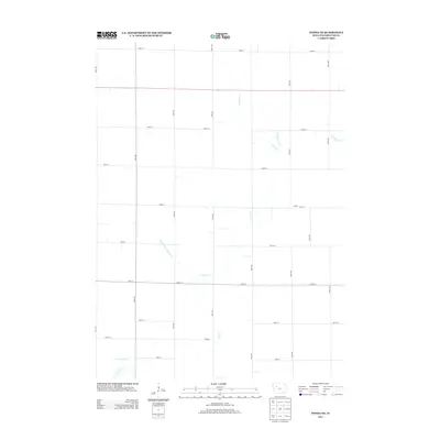
2013 Map of Fonda NE
USGS Topo · Published 2013About this map
Agricultural patterns and water management define this portion of Pocahontas County, where the settlement of Shirley sits amidst an organized grid of section roads. The landscape is primarily shaped by the winding course of Cedar Cr, which flows through the center of the sheet, and the headwaters of Little Cedar Cr in the southwest corner. The transition from natural stream beds to engineered drainage is evident through features like Ditch Number 21 and Drainage Ditch Number 74, reflecting the intensive land reclamation common in this part of Iowa. This 2013 survey provides a clear view of the rural infrastructure, capturing the intersection of local routes like 170th Ave and 550th St within the expansive prairie landscape, while the far eastern edge is marked by the S Br Lizard Cr.
Find a feature on this map
23 named features on this map. Tap any name to fly to it.
Don’t see what you’re looking for? This feature index may not catch every label — zoom into the map to look around manually.
Map Details
Editions of this 2013 Fonda NE Map
This is the sole edition of this map. No revisions or reprints were ever made.
Other maps of this area

1954 · Fort Dodge
USGS Topo · 1:250,000

1957 · Fort Dodge
USGS Topo · 1:250,000

1958 · Fort Dodge
USGS Topo · 1:250,000

1971 · Albert City
USGS Topo · 1:24,000

1971 · Laurens
USGS Topo · 1:24,000

1979 · Pocahontas
USGS Topo · 1:24,000

1979 · Varina
USGS Topo · 1:24,000

1979 · Fonda
USGS Topo · 1:24,000

1979 · Pomeroy
USGS Topo · 1:24,000

1979 · Newell East
USGS Topo · 1:24,000