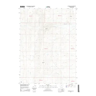
2015 Map of Fontenelle Gap
USGS Topo · Published 2015About this map
Fontenelle Gap serves as a prominent natural passage through the high-elevation terrain of Lincoln County, where the waters of Fontenelle Creek flow eastward. This 2015 survey details a landscape defined by significant drainage networks and varied topography, including the heights of Pine Ridge and the elongated Slate Creek Ridge. The map illustrates a remote part of western Wyoming where infrastructure is sparse, primarily consisting of Fontenelle Creek Rd following the watercourse through the gap. A series of seasonal and perennial streams, such as Dutch George Creek, Willow Creek, and Jackson Creek, carve through the townships. The inclusion of Rocky Gap in the southwest corner and N Fork Slate Creek indicates the complex watershed systems that define this high-country region.
Find a feature on this map
17 named features on this map. Tap any name to fly to it.
Don’t see what you’re looking for? This feature index may not catch every label — zoom into the map to look around manually.
Map Details
Editions of this 2015 Fontenelle Gap Map
This is the sole edition of this map. No revisions or reprints were ever made.
Other maps of this area

1936 · Cokeville
USGS Topo · 1:96,000

1942 · Cokeville
USGS Topo · 1:125,000

1945 · Fort Hill
USGS Topo · 1:62,500

1947 · Fort Hill
USGS Topo · 1:62,500

1954 · Ogden
USGS Topo · 1:250,000

1954 · Kemmerer
USGS Topo · 1:62,500

1955 · Preston
USGS Topo · 1:250,000

1958 · Ogden
USGS Topo · 1:250,000

1958 · Preston
USGS Topo · 1:250,000

1960 · Ogden
USGS Topo · 1:250,000