
1954 Map of Kemmerer
USGS Topo · Published 1972About this map
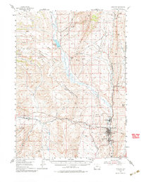
Hams Fork winds through a landscape of high ridges and industrial expansion during the mid-1950s, defining the corridor for the Union Pacific Railroad and the mining towns of Kemmerer, Diamondville, and Frontier. The terrain is marked by the Great Colorado River Basin Divide and the massive elevations of Commissary Ridge, which oversaw the path of westward migration along the Oregon Trail (Cutoff) and the Sublette Cutoff. Coal production is a primary driver of the local economy, evidenced by the large Elkol Strip Mine and numerous labeled excavations like the Frontier No 3 Mine (Abandoned). Beyond the coalfields, the map highlights the geological significance of the area with the Fossil Fish Quarries near Fossil Butte, where ancient aquatic life is preserved in the high desert strata. This survey provides a clear view of the intersection between pioneer history, heavy industry, and natural science in Lincoln County.
Find a feature on this map
46 named features on this map. Tap any name to fly to it.
Don’t see what you’re looking for? This feature index may not catch every label — zoom into the map to look around manually.
Map Details
Editions of this 1954 Kemmerer Map
2 editions found
Other maps of this area

1936 · Cokeville
USGS Topo · 1:96,000

1942 · Cokeville
USGS Topo · 1:125,000

1945 · Fort Hill
USGS Topo · 1:62,500

1947 · Fort Hill
USGS Topo · 1:62,500

1954 · Sage
USGS Topo · 1:62,500

1954 · Ogden
USGS Topo · 1:250,000

1955 · Preston
USGS Topo · 1:250,000

1958 · Ogden
USGS Topo · 1:250,000

1958 · Preston
USGS Topo · 1:250,000

1960 · Ogden
USGS Topo · 1:250,000