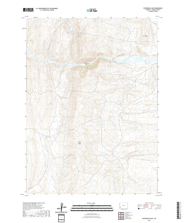
2021 Map of Fontenelle Gap
USGS Topo · Published 2021About this map
The historical Emigrant Trl cuts through the southwestern corner of this high-country landscape, marking a legacy of westward migration through Lincoln County. The terrain is defined by dramatic geological formations like the Fontenelle Gap and the high spine of Slate Creek Ridge, which separates the northern and southern watersheds. A network of drainages including Fontenelle Cr, Willow Cr, and Sheep Cr carve through the land, illustrating the drainage patterns of the upper Green River basin. In the northeast, Pine Ridge stands as a prominent landmark overlooking the valley, while local transportation is facilitated by routes such as Fontenelle Creek Rd and Co RD 314. The map provides a clear look at the Public Land Survey System grid across several townships, showing how ranching and migration routes shaped the remote Wyoming interior.
Find a feature on this map
18 named features on this map. Tap any name to fly to it.
Don’t see what you’re looking for? This feature index may not catch every label — zoom into the map to look around manually.
Map Details
Editions of this 2021 Fontenelle Gap Map
This is the sole edition of this map. No revisions or reprints were ever made.
Other maps of this area

1936 · Cokeville
USGS Topo · 1:96,000

1942 · Cokeville
USGS Topo · 1:125,000

1945 · Fort Hill
USGS Topo · 1:62,500

1947 · Fort Hill
USGS Topo · 1:62,500

1954 · Ogden
USGS Topo · 1:250,000

1954 · Kemmerer
USGS Topo · 1:62,500

1955 · Preston
USGS Topo · 1:250,000

1958 · Ogden
USGS Topo · 1:250,000

1958 · Preston
USGS Topo · 1:250,000

1960 · Ogden
USGS Topo · 1:250,000