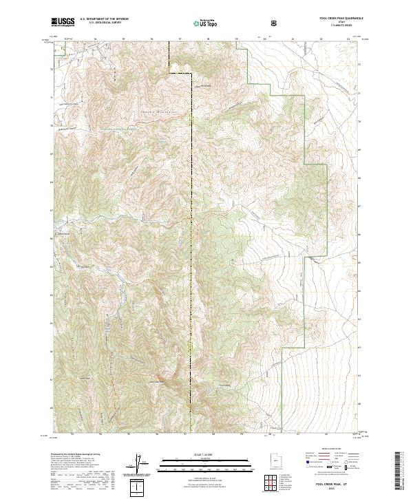
2023 Map of Fool Creek Peak
USGS Topo · Published 2023About this map
The high ridges of the Canyon Mountains define this section of the Fishlake National Forest on the border of Millard and Juab Counties. Central to the landscape is Fool Creek Peak, standing as a prominent landmark above a network of drainages including Davison Canyon, Netties Canyon, and Charley Johnson Canyon. The terrain is marked by a series of high-altitude water sources essential for the region, such as Mourning Dove Spring and Black Willow Spring, which indicate the sparse but vital hydrology of these uplands.
Find a feature on this map
48 named features on this map. Tap any name to fly to it.
Don’t see what you’re looking for? This feature index may not catch every label — zoom into the map to look around manually.
Map Details
Editions of this 2023 Fool Creek Peak Map
This is the sole edition of this map. No revisions or reprints were ever made.
Other maps of this area

1885 · Sevier Desert
USGS Topo · 1:250,000

1951 · Oak City
USGS Topo · 1:62,500

1952 · Scipio North
USGS Topo · 1:62,500

1953 · Delta
USGS Topo · 1:250,000

1958 · Delta
USGS Topo · 1:250,000

1962 · Delta
USGS Topo · 1:250,000

1962 · Lynndyl
USGS Topo · 1:62,500

1967 · Champlin Peak
USGS Topo · 1:24,000
1967 · Sage Valley
USGS Topo · 1:24,000

1979 · Lynndyl
USGS Topo · 1:100,000