
1967 Map of Champlin Peak
USGS Topo · Published 1969About this map
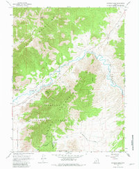
The Sevier River winds through a narrow gap between the Gilson Mountains and the Fish Lake Mountains in this late 1960s topographic study. This corridor serves as a vital transportation and irrigation artery, where the Union Pacific railroad tracks parallel the Leamington Canal and the river's course. Small railroad-related settlements and industrial points such as Soma, Uisco, and Parley are situated along the line, providing evidence of the region's mid-century rail and water management infrastructure.
Find a feature on this map
29 named features on this map. Tap any name to fly to it.
Don’t see what you’re looking for? This feature index may not catch every label — zoom into the map to look around manually.
Map Details
Editions of this 1967 Champlin Peak Map
2 editions found
Other maps of this area

1885 · Sevier Desert
USGS Topo · 1:250,000

1951 · Oak City
USGS Topo · 1:62,500

1952 · Scipio North
USGS Topo · 1:62,500

1953 · Delta
USGS Topo · 1:250,000

1958 · Delta
USGS Topo · 1:250,000

1962 · Delta
USGS Topo · 1:250,000

1962 · Lynndyl
USGS Topo · 1:62,500
1967 · Furner Ridge
USGS Topo · 1:24,000
1967 · Sage Valley
USGS Topo · 1:24,000
1967 · Jericho
USGS Topo · 1:24,000