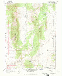
1967 Map of Furner Ridge
USGS Topo · Published 1969About this map
East Tintic Mountains terrain dominates this 1960s survey of Juab County, revealing a landscape defined by seasonal water management and passage through the high desert. The central Furner Ridge separates Furner Valley from Dog Valley, with Furner Pass providing the primary route across the divide. The presence of Tidwell Spring and several man-made catchments like Hole in Rock Reservoir and Dog Valley Reservoir illustrates the critical role of water infrastructure in supporting ranching or local industry during this era. Evidence of small-scale extraction is visible in scattered Prospects and a Gravel Pit, while a network of unimproved roads and a Jeep Trail suggests a remote, working landscape. These features, combined with the prominence of Dog Valley Wash, offer a clear picture of the geographic challenges and land-use patterns in this part of Utah prior to late-century developments.
Find a feature on this map
21 named features on this map. Tap any name to fly to it.
Don’t see what you’re looking for? This feature index may not catch every label — zoom into the map to look around manually.
Map Details
Editions of this 1967 Furner Ridge Map
This is the sole edition of this map. No revisions or reprints were ever made.
Other maps of this area

1885 · Manti
USGS Topo · 1:250,000

1885 · Sevier Desert
USGS Topo · 1:250,000

1895 · Manti
USGS Topo · 1:250,000

1951 · Santaquin
USGS Topo · 1:62,500

1951 · Nephi
USGS Topo · 1:62,500

1953 · Delta
USGS Topo · 1:250,000

1954 · Mc Intyre
USGS Topo · 1:24,000

1954 · Tintic Mountain
USGS Topo · 1:24,000

1956 · Price
USGS Topo · 1:250,000

1958 · Delta
USGS Topo · 1:250,000