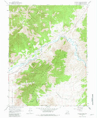
1967 Map of Champlin Peak
USGS Topo · Published 1981About this map
The Sevier River carves a critical corridor through the high desert of West-Central Utah, providing the lifeblood for early 20th-century irrigation and transport. This mid-1960s survey documents a landscape of dramatic verticality, where the Gilson Mountains and Fish Lake Mountains converge. The intricate network of the Sevier River Canal, Mc Intyre Canal, and Utah Central Canal reveals the extensive engineering required to manage water in this arid environment.
Find a feature on this map
29 named features on this map. Tap any name to fly to it.
Don’t see what you’re looking for? This feature index may not catch every label — zoom into the map to look around manually.
Map Details
Editions of this 1967 Champlin Peak Map
2 editions found
Other maps of this area

1885 · Sevier Desert
USGS Topo · 1:250,000

1951 · Oak City
USGS Topo · 1:62,500

1952 · Scipio North
USGS Topo · 1:62,500

1953 · Delta
USGS Topo · 1:250,000

1958 · Delta
USGS Topo · 1:250,000

1962 · Delta
USGS Topo · 1:250,000

1962 · Lynndyl
USGS Topo · 1:62,500

1967 · Champlin Peak
USGS Topo · 1:24,000
1967 · Furner Ridge
USGS Topo · 1:24,000
1967 · Sage Valley
USGS Topo · 1:24,000