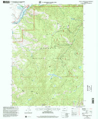
1997 Map of Foolhen Mountain
USGS Topo · Published 2002About this map
Beaverhead National Forest land dominates this high-country landscape near the Deer Lodge and Beaverhead county line. The terrain is defined by dramatic ridgelines like Foolhen Ridge and peaks including Trident Peak and Foolhen Mountain. Historically, the area supported both educational and industrial outposts, evidenced by the Fishtrap School situated near the confluence of Fishtrap Creek and the Big Hole River, and the Calvert Mine tucked beneath Calvert Hill. The network of drainages—from Walker Creek to Alder Creek—illustrates a complex watershed that feeds into the river system. For those interested in forest management and backcountry history, the map preserves the location of the Foolhen Ranger Cabin and the route of the Pioneer Loop NRT, which traverses through Trident Meadows.
Find a feature on this map
32 named features on this map. Tap any name to fly to it.
Don’t see what you’re looking for? This feature index may not catch every label — zoom into the map to look around manually.
Map Details
Editions of this 1997 Foolhen Mountain Map
This is the sole edition of this map. No revisions or reprints were ever made.
Other maps of this area

1955 · Dillon
USGS Topo · 1:250,000

1957 · Dillon
USGS Topo · 1:250,000

1958 · Dillon
USGS Topo · 1:250,000

1962 · Dillon
USGS Topo · 1:250,000

1962 · Lincoln Gulch
USGS Topo · 1:24,000

1962 · Lower Seymour Lake
USGS Topo · 1:24,000

1962 · Pine Hill
USGS Topo · 1:24,000
1962 · Dickie Hills
USGS Topo · 1:24,000
1962 · Foolhen Mountain
USGS Topo · 1:24,000

1962 · Proposal Rock
USGS Topo · 1:24,000