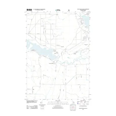
2012 Map of Foote Site Village
USGS Topo · Published 2012About this map
The Au Sable River corridor defines this portion of Iosco County, where the river widens into the Foote Dam Pond. This 2012 survey captures the area as a recreational and aviation hub, anchored by the Foote Site Village and the expansive Oscoda-Wurtsmith Airport to the east. Historically significant landmarks such as Chippewa Cem near Fawn Rd and the Sevenmile Hill Lookout Tower overlook a landscape shaped by water and timber heritage.
Find a feature on this map
69 named features on this map. Tap any name to fly to it.
Don’t see what you’re looking for? This feature index may not catch every label — zoom into the map to look around manually.
Map Details
Editions of this 2012 Foote Site Village Map
This is the sole edition of this map. No revisions or reprints were ever made.
Other maps of this area

1954 · Tawas City
USGS Topo · 1:250,000

1958 · Tawas City
USGS Topo · 1:250,000

1959 · Tawas City
USGS Topo · 1:62,500

1959 · East Tawas
USGS Topo · 1:62,500

1959 · Glennie
USGS Topo · 1:62,500

1959 · Harrisville
USGS Topo · 1:62,500

1983 · Hubbard Lake
USGS Topo · 1:100,000

1984 · Tawas City
USGS Topo · 1:100,000

1989 · Mikado
USGS Topo · 1:24,000
1989 · Greenbush
USGS Topo · 1:24,000