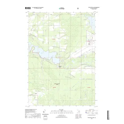
2019 Map of Foote Site Village
USGS Topo · Published 2019About this map
The Au Sable River winds through the heart of the Huron National Forest, anchoring a landscape defined by water management and recreational transit. The massive Foote Dam Pond dominates the central terrain, with Foote Site Village situated just downstream. This area serves as a significant crossroads for outdoor recreation, featuring the MI Shore to Shore Horse&Hike trail and the Eagle Run Hike & Ski Trail. To the northeast, the presence of the Oscoda-Wurtsmith Airport and Van Etten Lake signals the transition toward more developed infrastructure near the Lake Huron coast.
Find a feature on this map
66 named features on this map. Tap any name to fly to it.
Don’t see what you’re looking for? This feature index may not catch every label — zoom into the map to look around manually.
Map Details
Editions of this 2019 Foote Site Village Map
This is the sole edition of this map. No revisions or reprints were ever made.
Other maps of this area

1954 · Tawas City
USGS Topo · 1:250,000

1958 · Tawas City
USGS Topo · 1:250,000

1959 · Tawas City
USGS Topo · 1:62,500

1959 · East Tawas
USGS Topo · 1:62,500

1959 · Glennie
USGS Topo · 1:62,500

1959 · Harrisville
USGS Topo · 1:62,500

1983 · Hubbard Lake
USGS Topo · 1:100,000

1984 · Tawas City
USGS Topo · 1:100,000

1989 · Mikado
USGS Topo · 1:24,000
1989 · Greenbush
USGS Topo · 1:24,000