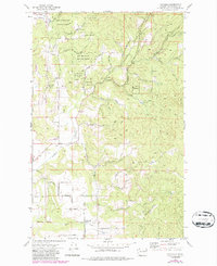
1973 Map of Foothills
USGS Topo · Published 1986About this map
Mt Spokane State Park dominates the northern reaches of this map, where the high terrain gives way to the drainage of Deadman Creek and its many seasonal tributaries. By the early 1970s, the foothills northeast of Spokane were defined by a transition from forested state land to a patchwork of small-scale agriculture and rural residential development. Local life centered on the small settlements of Foothills and Peone, while the infrastructure of the era is marked by the Green Bluff Substation and the Mt Spokane Fire Station.
Find a feature on this map
48 named features on this map. Tap any name to fly to it.
Don’t see what you’re looking for? This feature index may not catch every label — zoom into the map to look around manually.
Map Details
Editions of this 1973 Foothills Map
4 editions found
Other maps of this area

1901 · Spokane
USGS Topo · 1:125,000

1943 · Mt Spokane
USGS Topo · 1:62,500

1949 · Deer Park
USGS Topo · 1:62,500

1949 · Greenacres
USGS Topo · 1:62,500

1950 · Spokane NE
USGS Topo · 1:24,000

1950 · Mt Spokane
USGS Topo · 1:62,500

1950 · Spokane
USGS Topo · 1:62,500

1951 · Deer Park
USGS Topo · 1:62,500

1951 · Greenacres
USGS Topo · 1:62,500

1955 · Spokane
USGS Topo · 1:250,000