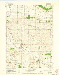
1962 Map of Footville
USGS Topo · Published 1964About this map
Footville and Hanover stand as primary rail-oriented settlements in this 1962 landscape, situated where the Chicago And North Western and Milwaukee St Paul And Pacific lines cross the agricultural plains of Rock County. The map reveals a highly developed rural social structure defined by family and community institutions, including the Grove Cem and several local educational landmarks such as the Red Brick Sch, Ellis Sch, and Bog Sch. The terrain is drained by the winding courses of Bass Creek, Marsh Creek, and Stevens Creek, while the presence of a Quarry, Gravel Pit, and Sandpit point to local extractive industries supporting the area's infrastructure. This survey captures the transition of these small Wisconsin villages as they maintained their rail-linked identities during the early 1960s.
Find a feature on this map
24 named features on this map. Tap any name to fly to it.
Don’t see what you’re looking for? This feature index may not catch every label — zoom into the map to look around manually.
Map Details
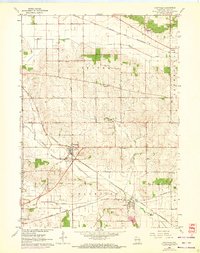
Editions of this 1962 Footville Map
2 editions found
Other maps of this area

1889 · Evansville
USGS Topo · 1:62,500

1890 · Stoughton
USGS Topo · 1:62,500

1891 · Janesville
USGS Topo · 1:62,500

1893 · Janesville
USGS Topo · 1:62,500

1893 · Brodhead
USGS Topo · 1:62,500

1894 · Evansville
USGS Topo · 1:62,500

1906 · Evansville
USGS Topo · 1:62,500

1954 · Rockford
USGS Topo · 1:250,000

1955 · Rockford
USGS Topo · 1:250,000

1958 · Rockford
USGS Topo · 1:250,000