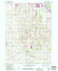
1960 Map of Foraker
USGS Topo · Published 1994About this map
The Elkhart River flows through the northeastern corner of this Indiana landscape, where the agrarian character of Jefferson and Harrison townships is defined by an extensive network of drainage projects. Features like Fulmer Ditch, Hoke Ditch, and Fetters Ditch crisscross the terrain, supporting the farms surrounding Foraker and Wakarusa. This 1960s-era topography, with revisions noted through the early 1990s, captures a dense concentration of local heritage sites, including the Bashor Childrens Home and numerous country houses of worship such as Bethel Ch and Wisler Ch. The presence of several family-named burial grounds like Wenger Cem and Hoke Cem provides a clear view of the area's genealogical roots. Near the settlement of Midway, the Midway Airport and proximity to Goshen show the gradual reach of infrastructure into the traditional rural countryside.
Find a feature on this map
47 named features on this map. Tap any name to fly to it.
Don’t see what you’re looking for? This feature index may not catch every label — zoom into the map to look around manually.
Map Details
Editions of this 1960 Foraker Map
4 editions found
Other maps of this area

1951 · Milford
USGS Topo · 1:24,000

1953 · Fort Wayne
USGS Topo · 1:250,000

1953 · Chicago
USGS Topo · 1:250,000

1956 · Fort Wayne
USGS Topo · 1:250,000

1957 · Chicago
USGS Topo · 1:250,000

1958 · Nappanee West
USGS Topo · 1:24,000

1958 · Osceola
USGS Topo · 1:24,000

1958 · Nappanee East
USGS Topo · 1:24,000

1959 · Goshen
USGS Topo · 1:24,000

1960 · Foraker
USGS Topo · 1:24,000