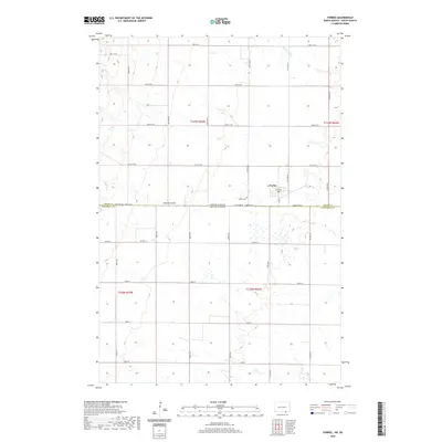
2020 Map of Forbes
USGS Topo · Published 2020About this map
Forbes sits at the northern edge of the interstate boundary, where the high plains of North Dakota meet South Dakota. This 2020 survey of the borderlands between Dickey Co and McPherson Co illustrates a landscape defined by its section-line road grid and drainage features like Hoevens Gulch and Webber Gulch. The town center is tightly clustered along Main St, featuring the local Po and 3rd Ave. To the east of the primary settlement lies the Forbes Cem, a key landmark for genealogical research in this rural pocket of the Dakotas. The surrounding terrain is sparsely populated, dominated by wide agricultural sections accessed by a network of numbered routes including Co Hwy 21 and State Line Rd.
Find a feature on this map
37 named features on this map. Tap any name to fly to it.
Don’t see what you’re looking for? This feature index may not catch every label — zoom into the map to look around manually.
Map Details
Editions of this 2020 Forbes Map
This is the sole edition of this map. No revisions or reprints were ever made.
Other maps of this area

1894 · Monango
USGS Topo · 1:62,500

1894 · Ellendale
USGS Topo · 1:62,500

1896 · Edgeley
USGS Topo · 1:125,000

1899 · Ellendale
USGS Topo · 1:125,000

1925 · Edgeley
USGS Topo · 1:125,000

1953 · Jamestown
USGS Topo · 1:250,000

1954 · Aberdeen
USGS Topo · 1:250,000

1956 · Aberdeen
USGS Topo · 1:250,000

1956 · Jamestown
USGS Topo · 1:250,000
1968 · Frederick NW
USGS Topo · 1:24,000