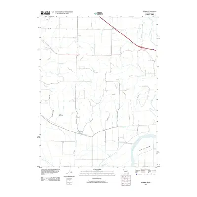
2009 Map of Forbes
USGS Topo · Published 2009About this map
Forbes and Richville anchor this corner of Holt County at the start of the 21st century, where the fertile lowlands of Burr Oak Bottom meet the rugged bluff country overlooking the Missouri River. The landscape is defined by a dense network of drainage, where the Nodaway River and McWilliams Creek cut through the terrain towards the river valley. For local historians, the sheet preserves several significant burial sites, including Brodback Cemetery to the north and Highland Cemetery situated near the bluffs. The presence of the Frank Milne Dam on Whales Creek and named hollows like Barrett Hollow and Hicks Hollow illustrate the complex interplay between human water management and the natural drainage patterns of the Missouri breaks. This survey provides a clear view of the rural road system, from the primary highway corridor at Richville to the network of county roads like Quill Rd and Sunset Dr.
Find a feature on this map
46 named features on this map. Tap any name to fly to it.
Don’t see what you’re looking for? This feature index may not catch every label — zoom into the map to look around manually.
Map Details
Editions of this 2009 Forbes Map
This is the sole edition of this map. No revisions or reprints were ever made.
Other maps of this area

1885 · Atchison
USGS Topo · 1:125,000

1888 · Atchison
USGS Topo · 1:125,000

1893 · Atchison
USGS Topo · 1:125,000

1924 · St. Joseph
USGS Topo · 1:62,500

1926 · Saint Joseph
USGS Topo · 1:62,500

1926 · Oregon
USGS Topo · 1:62,500

1926 · Maitland
USGS Topo · 1:62,500

1927 · Bolckow
USGS Topo · 1:62,500

1945 · Bolckow
USGS Topo · 1:62,500

1950 · Kansas City
USGS Topo · 1:250,000