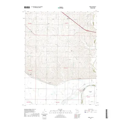
2017 Map of Forbes
USGS Topo · Published 2017About this map
The Missouri River defines the southwestern edge of this landscape, creating a wide alluvial plain at Burr Oak Bottom where the state line meets Doniphan Co, Kansas. In the bluffs rising from the river, the village of Forbes serves as a local landmark, surrounded by deep drainage features like Barrett Hollow and Hicks Hollow. This area of Holt County is characterized by numerous small waterways, including Forbes Cr and McWilliams Cr, which carve through the loess hills of Northwest Missouri.
Find a feature on this map
69 named features on this map. Tap any name to fly to it.
Don’t see what you’re looking for? This feature index may not catch every label — zoom into the map to look around manually.
Map Details
Editions of this 2017 Forbes Map
This is the sole edition of this map. No revisions or reprints were ever made.
Other maps of this area

1885 · Atchison
USGS Topo · 1:125,000

1888 · Atchison
USGS Topo · 1:125,000

1893 · Atchison
USGS Topo · 1:125,000

1924 · St. Joseph
USGS Topo · 1:62,500

1926 · Saint Joseph
USGS Topo · 1:62,500

1926 · Oregon
USGS Topo · 1:62,500

1926 · Maitland
USGS Topo · 1:62,500

1927 · Bolckow
USGS Topo · 1:62,500

1945 · Bolckow
USGS Topo · 1:62,500

1950 · Kansas City
USGS Topo · 1:250,000