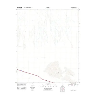
2012 Map of Ford Dry Lake
USGS Topo · Published 2012About this map
Ford Dry Lake dominates the southern landscape of this Riverside County desert expanse, appearing as a sprawling alkali basin within the Colorado Desert. This 2012 survey reveals the basin's drainage patterns, where ephemeral washes descend from the surrounding mountains and dissipate into the flat lake bed. The map documents the vital infrastructure of Interstate 10 as it cuts across the southwestern corner, serving as the primary transportation artery through this arid region. The lack of permanent settlements or structures underscores the area's character as a transition zone between mountain ranges and dry lake beds, where the topography is defined by natural drainage networks and the harsh environment of the desert floor.
Find a feature on this map
2 named features on this map. Tap any name to fly to it.
Don’t see what you’re looking for? This feature index may not catch every label — zoom into the map to look around manually.
Map Details
Editions of this 2012 Ford Dry Lake Map
This is the sole edition of this map. No revisions or reprints were ever made.
Other maps of this area

1942 · Blythe
USGS Topo · 1:250,000

1945 · Midland
USGS Topo · 1:62,500

1952 · Midland
USGS Topo · 1:62,500

1952 · Mc Coy Spring
USGS Topo · 1:62,500

1952 · Sidewinder Well
USGS Topo · 1:62,500

1952 · Palen Mountains
USGS Topo · 1:62,500

1954 · Salton Sea
USGS Topo · 1:250,000

1955 · Salton Sea
USGS Topo · 1:250,000

1959 · Salton Sea
USGS Topo · 1:250,000

1963 · Salton Sea
USGS Topo · 1:250,000