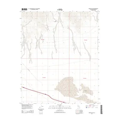
2015 Map of Ford Dry Lake
USGS Topo · Published 2015About this map
Palen Mountains dominate the northern landscape of this California desert region, where alluvial fans sweep down toward the vast expanse of Ford Dry Lake in the south. This environment is characterized by the arid transition between high-elevation terrain and the low-lying basin, a topography that has historically shaped travel and land use in this part of Riverside County. The presence of Palen Dunes Dr suggests modern access into this desert interior, skirting the edges of the dry lake bed which serves as a natural collector for the area's drainage. This survey documents the intersection of extreme natural features and the established township and range grids, providing a clear view of the territory as it existed in the early twenty-first century.
Find a feature on this map
7 named features on this map. Tap any name to fly to it.
Don’t see what you’re looking for? This feature index may not catch every label — zoom into the map to look around manually.
Map Details
Editions of this 2015 Ford Dry Lake Map
This is the sole edition of this map. No revisions or reprints were ever made.
Other maps of this area

1942 · Blythe
USGS Topo · 1:250,000

1945 · Midland
USGS Topo · 1:62,500

1952 · Midland
USGS Topo · 1:62,500

1952 · Mc Coy Spring
USGS Topo · 1:62,500

1952 · Sidewinder Well
USGS Topo · 1:62,500

1952 · Palen Mountains
USGS Topo · 1:62,500

1954 · Salton Sea
USGS Topo · 1:250,000

1955 · Salton Sea
USGS Topo · 1:250,000

1959 · Salton Sea
USGS Topo · 1:250,000

1963 · Salton Sea
USGS Topo · 1:250,000