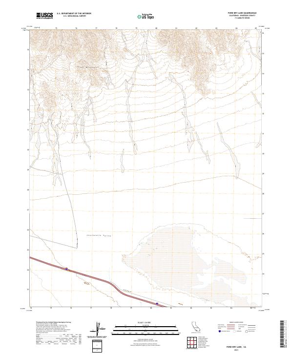
2021 Map of Ford Dry Lake
USGS Topo · Published 2021About this map
The Palen Mountains dominate the northern landscape of this desert terrain, giving way to the broad alluvial expanse of the Chuckwalla Valley to the south. This 2021 survey documents the stark environment of eastern Riverside County, where the dry basin floor is bisected by Palen Dunes Dr. The map shows a transition from high-relief topography in the north to the low-lying valley floor, an area historically significant for its role as a corridor for travel and utility development in the Colorado Desert. The precise delineation of township and range lines, such as t5s r18e and t6s r19e, provides a clear grid for property research and land management in this arid region.
Find a feature on this map
7 named features on this map. Tap any name to fly to it.
Don’t see what you’re looking for? This feature index may not catch every label — zoom into the map to look around manually.
Map Details
Editions of this 2021 Ford Dry Lake Map
This is the sole edition of this map. No revisions or reprints were ever made.
Other maps of this area

1942 · Blythe
USGS Topo · 1:250,000

1945 · Midland
USGS Topo · 1:62,500

1952 · Midland
USGS Topo · 1:62,500

1952 · Mc Coy Spring
USGS Topo · 1:62,500

1952 · Sidewinder Well
USGS Topo · 1:62,500

1952 · Palen Mountains
USGS Topo · 1:62,500

1954 · Salton Sea
USGS Topo · 1:250,000

1955 · Salton Sea
USGS Topo · 1:250,000

1959 · Salton Sea
USGS Topo · 1:250,000

1963 · Salton Sea
USGS Topo · 1:250,000